 Skip to content
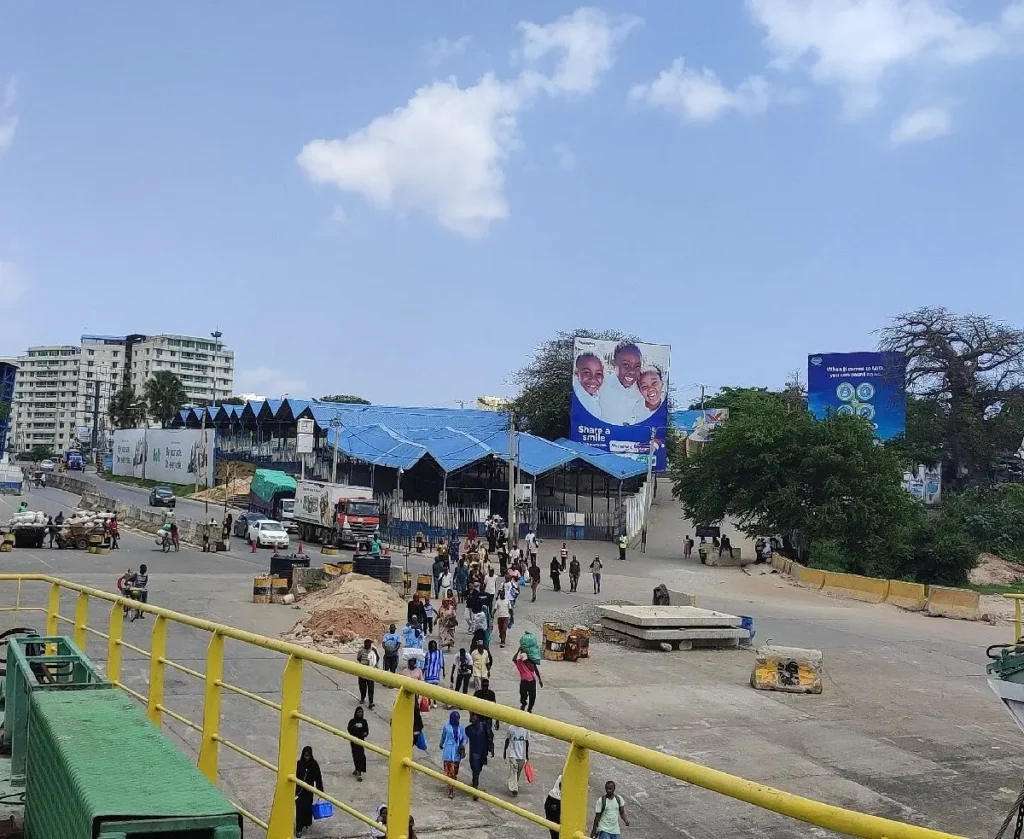
Getting around the Kenyan coast is an adventure, and for many, that journey begins with a short but iconic trip across the water. If you’re wondering where is the Likoni Ferry is located or need the most reliable Likoni Ferry directions for your 2026 trip, you’ve come to the right place.
This guide breaks down everything from exact map locations to the essential areas connected by this 24-hour service.
Likoni Ferry Guide: M-Pesa Paybill, Car Charges, Schedule, Timetable, Safety and Alternative Routes
Where is the Likoni Ferry located?
The Likoni Ferry is located in Mombasa, Kenya, crossing the Kilindini Harbour to connect Mombasa Island with the mainland suburb of Likoni. It serves as the primary gateway for travelers moving between the city center and the southern coastal strip.
- Mombasa Island Terminal (North): Situated at the southern end of the island, specifically at the terminus of Nyerere Avenue.
- Likoni Mainland Terminal (South): Located directly across the 500-meter channel, serving as the starting point for the Lunga Lunga Road (A14) heading toward Diani.
Navigating to the ferry is straightforward, whether you are walking, driving, or taking a taxi. Here are the most common Likoni ferry directions to help you reach the terminal:
Directions from Mombasa CBD (City Center)
The ferry is a mere 3.3 km from the heart of Mombasa.
- By Taxi/Ride-Hailing: The fastest way is a 4-minute drive via Nyerere Avenue. Expect to pay approximately KSh 300–400 for a standard ride.
- On Foot: If you are traveling light, it is a 37-minute walk (3.1 km) straight down Nyerere Avenue until you reach the water’s edge.
Directions from Moi International Airport (MBA)
If you are landing and heading straight to the South Coast, follow these Likoni ferry directions:
- Exit the airport and head toward the Makupa Causeway to enter Mombasa Island.
- Follow the arterial roads through the CBD (Digo Road or Moi Avenue) to connect with Nyerere Avenue.
- The total distance is approximately 15 km, and the drive typically takes 30–45 minutes depending on traffic.
Directions from the South Coast (Diani/Ukunda)
Are you planning to return to the city? Just follow the Lunga Lunga Road (A14) north. The road terminates exactly at the ferry ramp on the Likoni mainland.
Exact Map and Crossing Details
The ferry crossing is approximately 500 meters long, and the actual sail time is usually under 10 minutes.
- Frequency: Ferries typically depart every 10 minutes throughout the day.
- Peak Hours: To save time, it is advisable to avoid the rush hours between 6:00 AM and 8:30 AM, as well as between 4:00 PM and 8:00 PM, when wait times for vehicles can increase significantly.
Areas Connected by the Likoni Ferry
The ferry is a critical “pivot” for the region, bridging households with economic opportunities. It connects:
- Mombasa Island: The administrative and commercial core, featuring landmarks like Fort Jesus and the Old Town.
- South Coast (Kwale County): Famous resort areas like Diani Beach, Tiwi, and Shimoni.
- Tanzania Border: The crossing is part of the international transit route leading to the Lunga Lunga border post.
Quick Tips for Travelers
- Cost: The service is free for pedestrians.
- Vehicle Fees: Vehicles must pay a toll via M-Pesa. Standard saloon cars are charged between KSh 120 and KSh 250, while motorcycles pay KSh 50. Check out charges and vehicle categories guide
- Safety: Always keep your valuables in sight. For a more secure and scenic experience, consider heading to the upper seating areas of the modern ferries.
By following these Likoni ferry directions, you’ll find that crossing the channel is a convenient and essential part of the Mombasa experience.