
Where Is Mnarani Ruins Located?
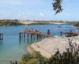
 The Mnarani Ruins are located in Kilifi County, on the northern coast of Kenya, overlooking the southern side of Kilifi Creek. The site occupies a prominent coral bluff, providing wide views of the creek and surrounding coastal landscape. This elevated position reflects the strategic planning typical of Swahili settlements along the East African coast.
Geographically, the ruins lie approximately 56 kilometers (35 miles) north of Mombasa and about 30 kilometers south of Malindi, placing them within a historically significant corridor of coastal trade and interaction. The exact coordinates of the site are 3°38′21.39″S, 39°50′37.27″E, marking its position near the shoreline of Kilifi Creek, which historically served as a sheltered anchorage and access point to inland routes.
Access to the Mnarani Ruins is via the Mombasa–Malindi road (A14 highway). The site is located approximately 200 metres from Kilifi Bridge, near the former ferry crossing. Visitors approaching from either direction can turn at the Mnarani junction and follow the old ferry road leading directly to the ruins.
The location of the Mnarani Ruins was of considerable importance in the context of Swahili coastal development. Its proximity to Kilifi Creek enabled maritime activities such as trade and transport, while the elevated terrain provided natural defense against potential attacks. In addition, nearby mangrove ecosystems supplied building materials and supported the local economy. These combined factors made the site well-suited for sustained settlement between the 14th and 17th centuries.
Mnarani Ruins’ location remains a key factor in its historical significance, illustrating how geography influenced settlement patterns, economic activity, and security within the wider network of Swahili ruins in Kenya.
History of Mnarani Ruins (14th–17th Century)
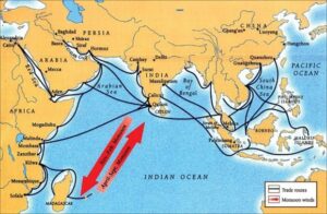
The Mnarani Ruins represent the remains of a Swahili settlement established along the Kenyan coast during the 14th century, a period associated with the expansion of Swahili civilization and increased participation in the Indian Ocean trade network. The settlement grew on a strategic bluff that looked out over Kilifi Creek. This gave it access to maritime trade routes and a natural defense. Archaeological evidence indicates that the site was part of a broader network of coastal towns that facilitated commerce between East Africa, Arabia, Persia, and India.
During the 15th century, Mnarani experienced significant growth and consolidation as a religious and urban center. At least two mosques were constructed, and evidence suggests a possible third structure, reflecting the importance of Islam within the community. The presence of pillar tombs with Arabic inscriptions further indicates the adoption of Islamic burial practices and suggests the existence of a socially stratified society. The use of coral stone in building construction is consistent with other Swahili ruins in Kenya, highlighting shared architectural traditions across the coast.
Material findings, including coins associated with the Kilwa Sultanate, suggest that Mnarani was economically connected to one of the most powerful trading states on the East African coast. These links demonstrate that the settlement was not isolated, but rather integrated into a complex system of regional and international trade. Goods such as ivory, mangrove poles, and possibly gold would have moved through such settlements, reinforcing their role in the wider Indian Ocean economy.
From the late 16th century, the stability of coastal settlements such as Mnarani began to decline due to external and internal pressures. The arrival of the Portuguese in East Africa following the voyage of Vasco da Gama introduced new political dynamics and disrupted established trade networks. Historical accounts describe conflicts involving coastal towns, including uprisings and military confrontations, which would have affected smaller settlements like Mnarani.
By the early 17th century, the site was abandoned. Archaeological and historical interpretations suggest that this abandonment resulted from a combination of factors, including declining access to fresh water, likely due to the drying of wells, as well as insecurity caused by regional conflicts and raids. Changes in trade patterns during the Portuguese period may have further reduced the economic viability of the settlement.
The history of Mnarani Ruins reflects the broader trajectory of Swahili coastal towns, from growth and prosperity driven by trade and religion to eventual decline under environmental and political pressures. Today, the site serves as an important example of Swahili heritage in Kilifi, offering insight into the cultural, economic, and religious life of the East African coast between the 14th and 17th centuries.
What You’ll See at Mnarani Ruins (Structures & Features)
The Mnarani Ruins preserve a range of architectural and archaeological features that reflect the structure of a Swahili coastal settlement between the 14th and 17th centuries. Although much of the site is now in ruins, the remaining elements provide clear evidence of religious, residential, and social organization within the community.
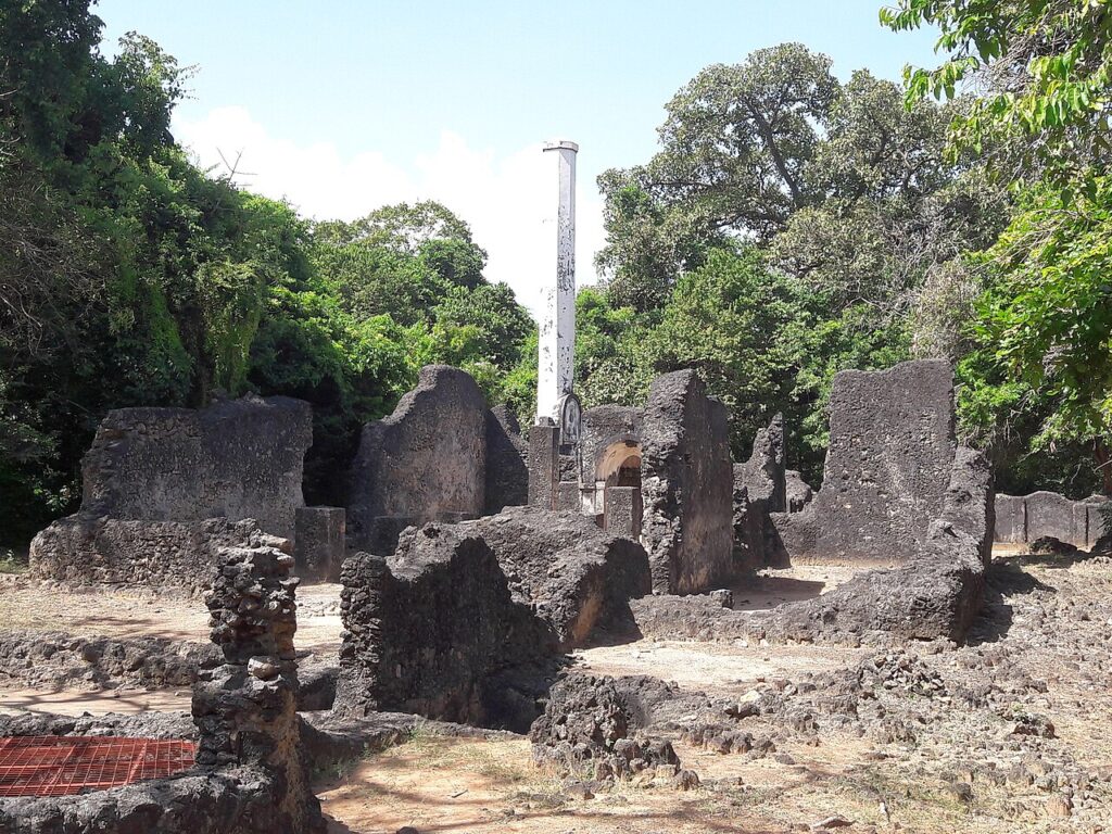
The most prominent structures at the site are the two mosques, constructed from coral rag stone. These mosques are oriented towards Mecca and include features such as the mihrab, a niche indicating the direction of prayer. The presence of multiple mosques suggests an established Muslim community with organized religious practices. Foundations indicating a possible third mosque have also been identified, pointing to continued development over time.
Adjacent to the mosques are several pillar tombs, which are among the most distinctive features of the site. These tombs are built using coral stone and are often decorated with Arabic inscriptions and carved details. Pillar tombs are typically associated with elite members of Swahili society, indicating social hierarchy and the importance of lineage and status within the settlement.
Scattered across the site are the remains of stone house foundations, which once formed part of a planned residential area. These structures were built using locally available coral and lime mortar, reflecting common building techniques used along the East African coast. The layout suggests an organized settlement, possibly enclosed by a boundary wall, with designated areas for living, worship, and burial.
One of the notable features associated with Mnarani is the octagonal pillar (mnara), from which the site derives its name. The term “Mnarani” comes from the Swahili word mnara, meaning a pillar or minaret. This structure is believed to have served as a symbolic or possibly navigational landmark, reinforcing the site’s identity and visibility within the coastal landscape.
In addition to built structures, the site includes remnants of a well, which would have served as a primary source of fresh water for the settlement. The eventual drying of this water source is considered one of the contributing factors to the abandonment of Mnarani in the early 17th century.
Together, these features make the Mnarani Ruins Kilifi an important example of Swahili ruins in Kenya, illustrating the architectural style, religious life, and settlement planning of the period. The combination of mosques, tombs, and domestic structures provides a comprehensive view of how coastal communities were organized and sustained.
The Unique Forest & Cultural Heritage at Mnarani Ruins
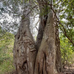 Beyond its archaeological remains, the Mnarani Ruins are distinguished by a unique combination of natural and cultural heritage. The site contains an indigenous forest patch that has developed over several centuries since the abandonment of the settlement. This forest, preserved within the boundaries of the ruins, provides insight into the long-term interaction between human habitation and natural regeneration along the Kenyan coast.
The forest at Mnarani is estimated to be over 400–500 years old, having grown after the decline of the Swahili settlement in the early 17th century. It consists of a variety of coastal plant species, some of which are known for their medicinal and ecological value. The presence of this forest contributes to a cool microclimate within the site and supports local biodiversity, including birds, insects, and small wildlife. Nature trails within the area allow visitors to experience this environment while observing plant species that have traditionally been used in local healing practices.
A significant cultural feature within the site is the baobab tree, which holds importance in the traditions of local communities. The tree has historically been associated with ritual practices, including prayers and ceremonies linked to rainmaking and community well-being. Such practices reflect the continuity of indigenous beliefs alongside the Islamic influences evident in the ruins, illustrating the layered cultural history of the area.
The coexistence of archaeological structures and a mature forest ecosystem makes Mnarani a rare example of a site where cultural heritage and natural heritage intersect. This dual significance enhances its value not only as a historical location but also as a place of environmental and cultural preservation.
The Mnarani Ruins in Kilifi offer more than just old buildings; they give visitors a chance to see how past human actions, spiritual beliefs, and the natural world connect within the larger story of Swahili heritage in Kenya.
Mnarani Snake Park (Reptile Rescue Experience)
 The Mnarani Snake Park, located within the grounds of the Mnarani Ruins, complements the historical experience by offering an educational and conservation-focused perspective on reptiles found along the Kenyan coast. The facility functions as a reptile rescue and rehabilitation center, where injured, displaced, or endangered species are cared for and, where possible, reintroduced into their natural habitats.
The park houses a variety of reptiles, including several species of snakes, as well as other animals such as tortoises and occasionally crocodiles. These reptiles are kept in controlled enclosures that allow visitors to observe them safely while learning about their behavior, ecological roles, and the importance of conservation. Informational guidance provided on-site helps to dispel common myths and misconceptions, particularly the widespread fear associated with snakes.
A key objective of the Mnarani snake park is public education. Visitors are given the opportunity to understand how reptiles contribute to maintaining ecological balance, especially in controlling pest populations. In some cases, supervised interactions are allowed, providing a controlled environment in which individuals can overcome fear of snakes and develop a more informed perspective.
The integration of the snake park within the historical setting of Mnarani enhances the overall visitor experience. It transforms the site from a purely archaeological destination into a multi-dimensional attraction, combining history, culture, nature, and wildlife education. This makes it one of the more distinctive Kilifi tourist attractions, appealing to both local and international visitors.
The presence of the reptile rescue center also reflects ongoing conservation efforts in the region, reinforcing the importance of protecting both cultural heritage and biodiversity. As part of a visit to the Mnarani Ruins Kilifi, the snake park provides an engaging and informative addition that broadens the scope of learning beyond the historical narrative.
Entry Fees, Opening Hours & Practical Visitor Information
Access to the Mnarani Ruins is managed by the National Museums of Kenya, and visitors are required to pay a conservation fee before entry. These fees are standardized across several historic sites in Kenya, including Mnarani, Gede, and Jumba ruins.
According to the official heritage conservation fees document (page 2), the current entry fees for Mnarani Ruins are as follows:
- Kenyan Citizens
- Adults: Ksh 100
- Below 16 years: Ksh 50
- East African Residents
- Adults: Ksh 400
- Below 16 years: Ksh 200
- Non-Residents (International Visitors)
- Adults: Ksh 500
- Below 16 years: Ksh 250
Download National Museum Of Kenya Museums Enrty Fees
These rates make Mnarani Ruins Kilifi one of the more affordable tourist attractions in Kilifi, especially for local visitors and students.
The site is open to the public daily from 8:30 AM to 6:00 PM, including weekends and public holidays, allowing visitors ample time to explore both the archaeological remains and the surrounding natural environment.
In addition to standard entry, there are optional experiences available across similar heritage sites, such as guided tours and night tours, which may be arranged in advance or on-site depending on availability. These provide deeper insights into the history of Mnarani Ruins and enhance the visitor experience.
Visitors are advised to wear comfortable walking shoes, carry water, and plan their visit during cooler hours of the day due to the open coastal environment. The presence of both historical structures and natural trails means that exploration may involve uneven terrain.
Overall, the affordability, accessibility, and structured management of the site contribute to making Mnarani Ruins a well-maintained and visitor-friendly destination within the broader network of Swahili ruins in Kenya.
Directions to Mnarani Ruins
 The Mnarani Ruins are easily accessible via the main coastal highway, making them one of the most convenient Kilifi tourist attractions to visit. The site is located just off the Mombasa–Malindi Road (A14), near the well-known Kilifi Bridge, which serves as the primary landmark for navigation.
Visitors traveling from Mombasa should head north along the A14 highway toward Kilifi. After crossing or approaching Kilifi Bridge, a turn at the Mnarani junction—approximately 100 metres from the bridge—leads to the site. From this junction, the route follows the old ferry road, which descends toward the former ferry crossing area where the ruins are situated.
For those coming from Malindi, the journey involves traveling south along the same highway. Upon reaching Kilifi Bridge, visitors should take the Mnarani junction shortly before or after the bridge (depending on direction), then proceed along the old ferry road to reach the site.
Public transport options are also available. Travelers can use matatus or buses operating along the Mombasa–Malindi route and alight at Kilifi town near the bridge. From there, the ruins are a short distance away and can be reached by motorcycle taxi (boda boda) or on foot.
The final stretch of the journey leads to the southern side of Kilifi Creek, near the abandoned ferry berth, where the ruins are located. The road is generally accessible, although the last section may be slightly uneven, especially during rainy conditions.
Due to its proximity to major transport routes and clear landmarks, reaching Mnarani Ruins Kilifi is straightforward for both local and international visitors. Its accessibility further enhances its appeal as a must-visit destination among Swahili ruins in Kenya.
Why Mnarani Ruins Matter (Historical Importance & Significance)
 The Mnarani Ruins hold significant historical value as part of the broader network of Swahili coastal settlements that flourished between the 14th and 17th centuries. These settlements formed a key component of the Indian Ocean trade system, linking East Africa with Arabia, Persia, India, and beyond. Mnarani’s location along Kilifi Creek positioned it within this network, enabling participation in regional and international exchange.
One of the most important aspects of Mnarani Ruins history is its role in illustrating the spread and influence of Islam along the East African coast. The presence of multiple mosques, along with tombs bearing Arabic inscriptions, reflects the integration of Islamic religious practices into daily life. This cultural and religious influence shaped not only architecture but also education, governance, and social organization within Swahili communities.
Mnarani also contributes to the understanding of urban development in early coastal towns. The site shows evidence of planned settlement, including residential areas, religious structures, burial sites, and defensive features such as boundary walls. These elements demonstrate that Swahili settlements were not informal villages, but rather organized urban centers with defined spatial structures and social hierarchies.
In addition, the site provides insight into the economic systems of the Swahili coast. Archaeological findings, including coins associated with the Kilwa Sultanate, confirm that Mnarani was connected to powerful trade networks. Through these connections, goods such as ivory, mangrove poles, and other commodities were exchanged, contributing to the prosperity of the settlement.
The eventual abandonment of Mnarani highlights the vulnerability of coastal settlements to environmental and political changes. Factors such as water scarcity, conflict, and disruption of trade routes during the Portuguese period demonstrate how external pressures could lead to the decline of once-thriving communities. This makes Mnarani an important case study in understanding the rise and fall of Swahili towns.
Today, the Mnarani Ruins Kilifi serve as an essential cultural and educational resource. They help preserve and communicate the history of Swahili ruins in Kenya, offering valuable insights into the region’s past. As part of Kenya’s national heritage, the site continues to play a role in research, tourism, and the promotion of cultural identity.
Things to Do at Mnarani Ruins (Visitor Experience Guide)
A visit to the Mnarani Ruins offers a combination of history, nature, and cultural exploration, making it one of the most engaging things to do in Kilifi. The site provides a well-rounded experience for visitors interested in both archaeology and the natural environment.
One of the main activities at Mnarani Ruins Kilifi is exploring the ancient structures, including the mosques, pillar tombs, and remains of stone houses. Walking through the site allows visitors to observe the layout of a former Swahili settlement and understand how different parts of the community were organized. The ruins provide a tangible connection to the history of Mnarani Ruins, making exploration both educational and immersive.
The site is also popular for photography, particularly due to its elevated position overlooking Kilifi Creek. The combination of coral stone ruins, surrounding forest, and water views creates ideal conditions for capturing scenic and historical images. Early morning and late afternoon visits offer the best lighting, enhancing both landscape and architectural photography.
Visitors can also enjoy nature walks through the indigenous forest, where shaded trails provide a calm and refreshing environment. These walks offer an opportunity to observe local plant species, birds, and insects, while experiencing the unique blend of natural and historical surroundings that define the site.
Another key activity is visiting the nearby Mnarani Snake Park, where guests can learn about reptiles and conservation efforts. This adds an interactive and educational dimension to the visit, particularly for families and students.
For those interested in a deeper understanding, guided tours may be available, offering detailed explanations of the site’s structures, history, and cultural significance. These tours enhance the experience by providing context that may not be immediately visible when exploring independently.
Overall, the range of activities available makes Mnarani Ruins a versatile destination, combining elements of history, education, and leisure. This diversity contributes to its growing reputation among Kilifi tourist attractions and strengthens its appeal to a wide range of visitors.
Mnarani Ruins vs Other Kenyan Ruins (Comparison & Unique Value)
The Mnarani Ruins are often compared with other well-known Swahili ruins in Kenya, particularly Gede Ruins and Jumba la Mtwana. While all three sites share similarities in architecture and historical context, each offers a distinct experience and contributes differently to the understanding of Swahili coastal civilization.
The Gede Ruins are among the largest and most extensively studied archaeological sites in Kenya. They feature a wide range of structures, including houses, mosques, and a palace complex, all set within a dense forest. Compared to Gede, Mnarani is smaller in scale but offers a more intimate and less crowded experience, making it easier for visitors to explore and interpret the site without the complexity of a large urban layout.
Jumba la Mtwana, located closer to Mombasa, is known for its well-preserved residential houses and proximity to the ocean. While it provides insight into domestic architecture and coastal living, it lacks the elevated vantage point and strong defensive positioning seen at Mnarani. In contrast, Mnarani’s location on a bluff overlooking Kilifi Creek highlights its strategic importance in trade and security.
One of the key features that distinguishes Mnarani Ruins Kilifi is the presence of the octagonal pillar (mnara), which gives the site its name and identity. Additionally, the integration of an indigenous forest and cultural elements, such as the sacred baobab tree, creates a unique blend of natural and historical significance that is less pronounced at other sites.
Mnarani also stands out for combining multiple experiences within a single location. In addition to the ruins themselves, visitors can explore the snake park, engage with local cultural traditions, and enjoy scenic views of Kilifi Creek. This multi-dimensional experience makes it particularly appealing for visitors seeking both education and leisure.
In terms of accessibility, Mnarani is conveniently located near Kilifi Bridge, making it easier to reach compared to some other sites. This accessibility, combined with its affordability and diverse attractions, enhances its appeal as one of the emerging Kilifi tourist attractions.
Overall, while sites like Gede and Jumba la Mtwana may be larger or more widely known, the Mnarani Ruins offer a distinctive combination of history, location, cultural heritage, and natural environment, making them a unique and valuable destination within Kenya’s coastal heritage landscape.